

Beautifully engraved certificate from Jib Consolidated Mining Company issued in 1925 This historic document was printed by the American Banknote Company and has an ornate border around it with a vignette of an eagle. This item has the signatures of the Company's President, M. Thompson and Secretary, H. D. Moran and is over 80 years old. 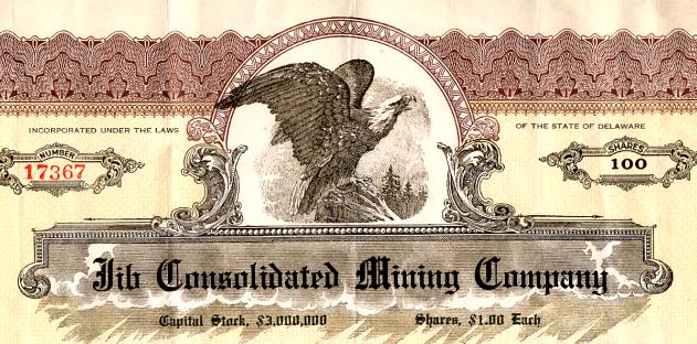
Certificate Vignette The Basin mining district, also known as the Jefferson district, is on the eastern slope of the Continental Divide, north of Interstate 15 and the Boulder River between the small communities of Bernice and Basin. Often the Cataract and High Ore districts are considered sub-districts of a larger Basin district. Basin, Cataract, High Ore and Red Rock creeks flow from the high mountains north of Basin into the Boulder River, all within three miles on either side of the town. The mouth of Cataract Creek is less than a half mile below the mouth of Basin Creek. The Basin, Cataract, and High ore districts are primarily underlain by quartz monzonite of the Boulder batholith. The quartz monzonite of the northern portion of the district is overlain by tertiary dacite, and the quartz monzonite on the western edge of the district is overlain by late Cretaceous andesite. The andesite deposits are pre-batholithic, and the dacite deposits are post-batholithic. The andesite and monzonite formations are cut by dikes of dacite and rhyolite. The district contains both placer and lode ore deposits, the lode deposits being of late Cretaceous and Tertiary ages. The older lodes are valued for their silver, lead and zinc content, while the younger lodes are valued for their gold and silver content. Limited open fissures occur, which contain deposits represented by both groups. A unique formation in the district is a disseminated gold deposit in granite, which occurs west of Basin along Red Rock creek (Sahinen1935:47). Gold deposits at the mouth of Cataract Creek were reported to have been located as early as the summer of 1862 by prospectors who staked claims. However, these claims were quickly abandoned for the reportedly richer diggings on Grasshopper Creek. These abandoned claims were then acquired by James and Granville Stuart, and Reece Anderson who built cabins at the mouth of the Cataract Creek. Two years later placer deposits were found two and a half miles further up the creek but, although rich, the ore was too difficult to work and the claims were abandoned. Soon after, however, placer mining activities quickly spread over the length of both Basin and Cataract creeks. Some of the deposits turned out to be moderately profitable, although nothing like the bonanza placers at Last Chance Gulch or Alder Gulch were encountered (Lyden 1948; Wolle 1963; Becraft et al. 1963). A small mining camp grew up on the flat at the confluence of the Boulder River and Cataract Creek, but when the town of Basin was established at the mouth of Basin Creek a half mile to the west, the buildings at Cataract were gradually moved to Basin, eventually leaving no trace of the Cataract camp (Wolle 1963). The initial placer deposits gave out within a few years and prospectors fanned out to prospect for the lode veins. Most of the lodes were discovered during the early 1870s but the miners, in most cases, did not have the capital or equipment to develop them. Eventually, significant lode mines such as the Eva May, Uncle Sam, Grey Eagle and Hattie Ferguson in the Cataract district and the Bullion, Hope and Katy in the Basin district were established. In 1880 the cluster of cabins at the mouth of Basin Creek officially became Basin City. Over the next two decades the town was an active camp, supplying the mines and miners in the district (Knopf 1913; Wolle 1963). It prospered in spite of several disastrous fires, the last occurring in 1893, and by 1905 the population had reached 1500 persons (Pardee and Schrader 1933; Becraft et al. 1963; Wolle 1963). A factor which limited the district's development prior to the 1880s, was the need for smelters which could treat the complex ores. As early as 1867, a smelter was built across the divide at the Gregory mine near Wickes in the Colorado district, followed shortly after by a similar plant at the Minah mine, also near Wickes. Concentrators using gravity methods were constructed at the Comet and Eva May mines in the Cataract sub-district but none of these early operations were very efficient (Becraft et al. 1963). In 1883 the railroad line from Helena to Wickes was completed and the smelter at Wickes was remodeled and enlarged. These developments provided an incentive to mining throughout the area, resulting in a boom which lasted about a decade until the silver panic of 1893 forced many of the region's mines to shut down. In addition, many of the leading mines had reached depths where it was too expensive to mine using wood-fired steam plants and, in some cases, the good ore had been mined out. Few production records were kept during this period but it has been estimated the Basin district produced about $8,000,000 in gold (Pardee and Schrader 1933; Becraft et al. 1963). Most mining throughout the region south of Helena, from this point on, consisted of smaller-scale operations, carried out with limited capital and equipment. For the most part, old tailings dumps were reworked or old mine workings were reopened on a reduced scale. The Basin district, however, was somewhat of an exception to this trend with a number of major mining operations being developed after the turn of the century. The Katy and Hope mines were reorganized by the Basin & Bay State Mining Company in 1894. The mines prospered in the 1890s despite low silver prices. A new mill was built at the Katy which ran successfully until the mine flooded and the mill burned down in 1895. The following year the Hope mine's concentrator also caught fire. In 1905 the Basin Reduction Company took over the operation and spent $500,000 building and equipping a 1500-ton smelter and concentrator which reworked the mine tailings; the mill ran at full capacity for several years around 1906, but by 1911 it was idle. Both mines, along with the White Elephant, were later reopened by the Jib Consolidated Mining Company in 1924, and produced $1,700,000 in gold before the operation was forced to close due to mismanagement and stock market manipulations, thus ending Basin's last major mining boom (Calderhead 1898; 1900; Hall 1912; Pardee and Schrader 1933; Becraft et al. 1963; Wolle 1963). Since then, small-scale mining, the reworking of older mine dumps as at the Comet, and a few placer operations have been conducted in the greater Basin district. BOUNDARIES OF THE MINING DISTRICT The Basin district is a term that has variously been applied to a small sub-district which runs the length of Basin Creek or can be applied to a larger district. The lesser district is confined to the Basin Creek drainage. The greater district also includes the Cataract and High Ore sub-districts and has even included mines in the Colorado district. Basin, Cataract and High Ore creeks flow from north to south into the Boulder River, all joining it near the town of Basin. As is often the case, the historic definitions of the districts are indeterminate, at best. History from State of Montana Website.
Certificate Vignette


